Skip to main content

Pressly Forum: Divya Kumar-Dumas, "From Text to Terrain: Experimenting with Relational DH"

Divya Kumar-Dumas

Pressly Forum: Divya Kumar-Dumas, "From Text to Terrain: Experimenting with Relational DH"

Art History and Archaeology Wednesday, September 3, 2025 12:00 pm - 1:00 pm Parren J. Mitchell Art/Sociology Building, 4213A, Michelle Smith Collaboratory for Visual Culture

Dr. Divya Kumar-Dumas has joined our Department this semester as a Presidential Postdoctoral Fellow in South Asian and Global Art & Architecture. Her World Architecture class this semester invites the students to use Omeka + Neatline as a tool for learning and research. Seh'll be teaching the Asian Art Survey (ARTH 290) in spring. In this Pressly Forum, Dr. Kumar-Dumas will discuss her work and praxis working and teaching with digital humanities platforms and tools.

"This talk begins with a question that once stalled my research: How do we trace a garden from art historical representation when texts are lush and plentiful, but the land reveals little–or differently–and our intellectual frameworks have proven inefficient? Working across Southern Asian contexts, I kept returning to the friction between literary descriptions of garden-making and the archaeological record of built space. That tension drew me toward new modes of interpreting—across disciplines, and increasingly, through digital tools.

As I begin my time in the Department of Art History and Archaeology, this talk introduces my research trajectory alongside collaborative commitments that have brought me into conversation with digital humanities approaches. My core work spans first-millennium landscape history, material culture, and transregional exchange across South Asia and the Indian Ocean. While I am not a digital specialist, digital tools have repeatedly served as invitations: to experiment, to collaborate, and to de-silo.

I’ll reflect on three recent projects:

  • A classroom-based Omeka catalog designed to foreground student curation and engage both canonical and overlooked architectural forms;
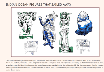
  • A workshop website developed to support the study of transcultural images–specifically figurines I’ve termed “Indian Ocean Figures” that circulated far beyond the subcontinent; 
screen shot of https://isaw.nyu.edu/research/io-figures
Screen grab of "Indian Ocean Figures that Sailed Away," a workshopped website at the website of the Institute of the Study of the Ancient World, New York University

and

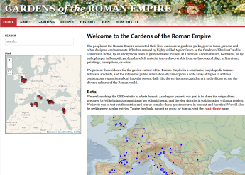
  • An evolving digital catalog of Roman gardens as archaeological landscapes, building on a project whose conceptual roots were planted in this very department over fifty years ago. 
screen grab of https://roman-gardens.github.io/home/
Screen grab of Gardens of the Roman Empire, a website drawing on the extensive records of Prof. Wilhelmina Jashemski and her team over the years of their work.


Each of these projects asks what becomes possible when we shift the frame: from text to terrain, from specialization to shared authorship, from canons to networks. I’ll speak candidly about what worked, what didn’t, and what I hope to learn from those with more experience in digital pedagogy and public-facing research. This is not a how-to, but a how-I’m-learning, and what I hope will be an invitation to think together at the edges of image, text, and place."

The Pressly Forum offers members of Department faculty and selected speakers to give a talk to members of the Department (faculty, staff, students) in an effort to create bonds of intellectual and collegial community. The forum is the brainchild of Professor Emeritus William L. Pressly, after whom the forum now is named. A light lunch will be served at 11:30.

Map of the Coromandel and Malabar Coasts from Philippus Baldaeus, A True and Exact Description of the Most Celebrated East-India Coasts of Malabar and Coromandel (1671).
Map of the Coromandel and Malabar Coasts from Philippus Baldaeus, A True and Exact Description of the Most Celebrated East-India Coasts of Malabar and Coromandel (1671). Created by a Dutch missionary in the 17th century, this map reflects early colonial efforts to spatialize South Asia’s coasts and islands through textual and visual means. Its richly inscribed surface—radiating compass lines, dense labels, and decorative cartouches—renders a world at once navigable and imagined. Used here as a starting point for reconsidering how gardens, landscapes, and environments can be traced beyond textual sources.


Add to Calendar 09/03/25 12:00:00 09/03/25 13:00:00 America/New_York Pressly Forum: Divya Kumar-Dumas, "From Text to Terrain: Experimenting with Relational DH"

Dr. Divya Kumar-Dumas has joined our Department this semester as a Presidential Postdoctoral Fellow in South Asian and Global Art & Architecture. Her World Architecture class this semester invites the students to use Omeka + Neatline as a tool for learning and research. Seh'll be teaching the Asian Art Survey (ARTH 290) in spring. In this Pressly Forum, Dr. Kumar-Dumas will discuss her work and praxis working and teaching with digital humanities platforms and tools.

"This talk begins with a question that once stalled my research: How do we trace a garden from art historical representation when texts are lush and plentiful, but the land reveals little–or differently–and our intellectual frameworks have proven inefficient? Working across Southern Asian contexts, I kept returning to the friction between literary descriptions of garden-making and the archaeological record of built space. That tension drew me toward new modes of interpreting—across disciplines, and increasingly, through digital tools.

As I begin my time in the Department of Art History and Archaeology, this talk introduces my research trajectory alongside collaborative commitments that have brought me into conversation with digital humanities approaches. My core work spans first-millennium landscape history, material culture, and transregional exchange across South Asia and the Indian Ocean. While I am not a digital specialist, digital tools have repeatedly served as invitations: to experiment, to collaborate, and to de-silo.

I’ll reflect on three recent projects:

  • A classroom-based Omeka catalog designed to foreground student curation and engage both canonical and overlooked architectural forms;
  • A workshop website developed to support the study of transcultural images–specifically figurines I’ve termed “Indian Ocean Figures” that circulated far beyond the subcontinent; 
screen shot of https://isaw.nyu.edu/research/io-figures
Screen grab of "Indian Ocean Figures that Sailed Away," a workshopped website at the website of the Institute of the Study of the Ancient World, New York University

and

  • An evolving digital catalog of Roman gardens as archaeological landscapes, building on a project whose conceptual roots were planted in this very department over fifty years ago. 
screen grab of https://roman-gardens.github.io/home/
Screen grab of Gardens of the Roman Empire, a website drawing on the extensive records of Prof. Wilhelmina Jashemski and her team over the years of their work.


Each of these projects asks what becomes possible when we shift the frame: from text to terrain, from specialization to shared authorship, from canons to networks. I’ll speak candidly about what worked, what didn’t, and what I hope to learn from those with more experience in digital pedagogy and public-facing research. This is not a how-to, but a how-I’m-learning, and what I hope will be an invitation to think together at the edges of image, text, and place."

The Pressly Forum offers members of Department faculty and selected speakers to give a talk to members of the Department (faculty, staff, students) in an effort to create bonds of intellectual and collegial community. The forum is the brainchild of Professor Emeritus William L. Pressly, after whom the forum now is named. A light lunch will be served at 11:30.
Map of the Coromandel and Malabar Coasts from Philippus Baldaeus, A True and Exact Description of the Most Celebrated East-India Coasts of Malabar and Coromandel (1671).
Map of the Coromandel and Malabar Coasts from Philippus Baldaeus, A True and Exact Description of the Most Celebrated East-India Coasts of Malabar and Coromandel (1671). Created by a Dutch missionary in the 17th century, this map reflects early colonial efforts to spatialize South Asia’s coasts and islands through textual and visual means. Its richly inscribed surface—radiating compass lines, dense labels, and decorative cartouches—renders a world at once navigable and imagined. Used here as a starting point for reconsidering how gardens, landscapes, and environments can be traced beyond textual sources.


Parren J. Mitchell Art/Sociology Building false